This is a photo sequence of one of the world's most scenic roads, a heavenly 230km along the continental divide of North America, passing majestic glaciers, brilliant turquoise lakes, and sweeping valleys cutting between the wild jagged peaks of the Canadian Rockies. If I have only one day to bring an friend from overseas to see the best of Canada, this would be my pick.
And it's not only my pick -- National Geographic has it listed among the 50 best drives in the world, as well as the Top 10 ski trips in the world; Lonely Planet ranks it among the world's top 10 cycling trips; UNESCO protects the entire surrounding area as a World Heritage Site. Welcome to Icefields Parkway.
0km from Jasper
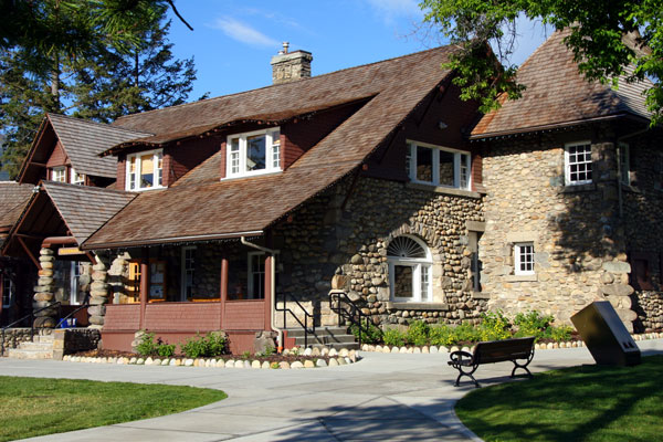
Our journey started from the Jasper Townsite. Pictured is the Jasper Information Centre, one of the finest pieces of rustic Canadian architecture and a National Historic Site in itself. Constructed of cobblestones and timber nearly 100 years ago, the relatively small structure originally housed a plethora of park functions, including a fish hatchery in the basement. Most visitors no longer arrive at the rail station across the street, but the old building still serves as the town's most recognizable landmark.
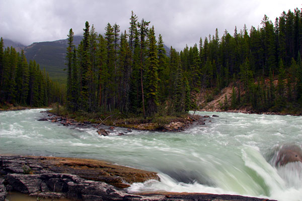
31km from Jasper
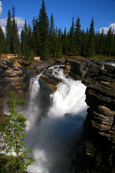
The Athabasca Falls is the first of several major waterfalls and canyons along Icefields Parkway. Glacial water originating from the Columbia Icefield carves a narrow canyon through the soft limestone here to continue its way towards the Arctic Ocean.

Dramatic flowing lines were once scribed on these limestone walls by the mighty Athabasca River, which has since carved out a new channel underneath. A well-maintained trail now leads visitors through these passages, ending at the other side of the rocks with a sweeping view of the river valley.
55km from Jasper
A 15 minute drive to the south, the turbulent waters of the spectacular Sunwapta Falls plunges down another chasm and will eventually join the Athabasca River. Just below these waterfalls is the launch point of a Class 3 white water rafting course, a 2-hour journey costing less than CAD$100.

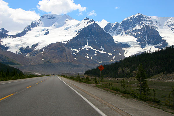
100km from Jasper
At the legal speed limit of 90km/h the entire drive from Jasper to Banff can theoretically be covered in less than four hours. It took us no less than eight -- and it was eight hours of breathtaking scenery and short hikes launching directly from the roadside. Pictured is a view of North America's continental divide from a roadside pullover with no name.
103km from Jasper
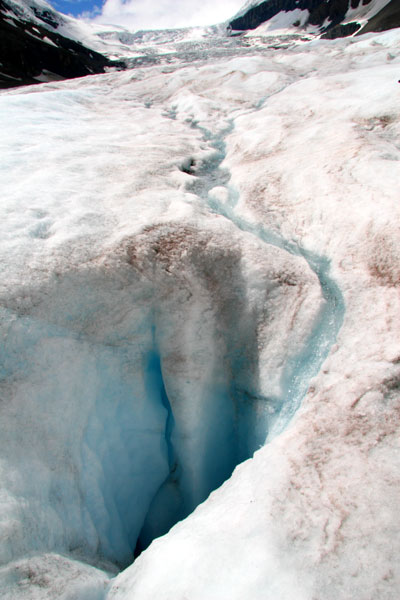
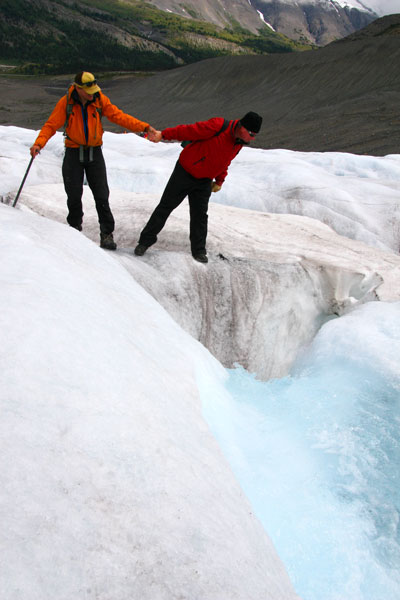
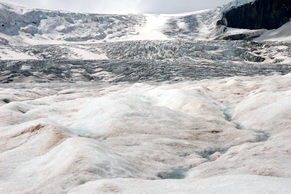
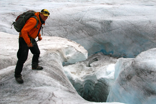
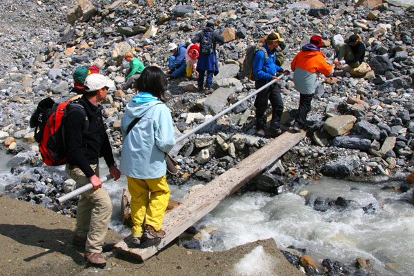
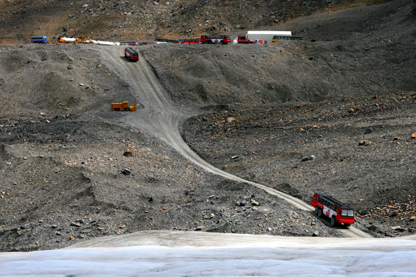
The 300-plus-metres-thick Columbia Icefield marks the boundary between Banff National Park and Jasper National Park. Directly accessible from the side of the highway is the Athabasca Glacier, one of the six toes of the icefield and the most visited glacier in North America. If you've come this far to the Canadian Rockies, don't miss the chance to set foot on the ice pack. Please see our Athabasca Glacier page for a quick glimpse of what you may see on a guided hike up the glacier.

160km from Jasper
A 40 minute drive into Banff National Park leads to yet another spectacular valley. The Mistaya River carves a winding path through stratified layers of limestone and creates a narrow slot canyon on its way towards Edmonton, and eventually the Hudson Bay.
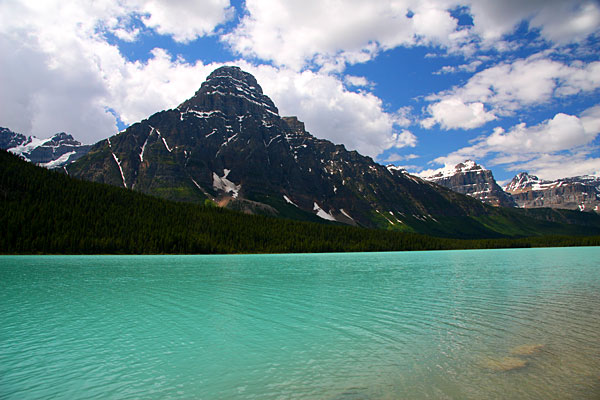
175km from Jasper
At about 100km north of Banff the Icefields Parkway starts entering the heart of lake country. The pictured Lower Waterfowl Lake is just one of hundreds of lakes in the region, all endowed with the brilliant turquoise waters that made the Canadian Rockies famous.
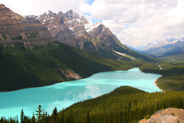
182km from Jasper
This well-signposted trail starting from the roadside is one of the most popular short hikes in Canada -- which leads to one of the best viewpoints in Canada. We had to contend with hordes of multi-national tourists on the 20-minute hike, but the view, 300-metres above the brilliant Peyto Lake and its magical surroundings, alone makes visiting the Rockies worthwhile.
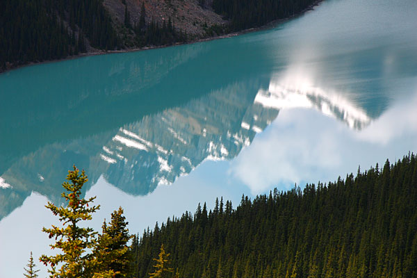
Aside from boasting one of the most breathtaking views in the Canadian Rockies, this viewpoint area, known as Bow Summit, is also famous as the highest point along the Icefields Parkway at 2,069m. Time your visit in July to September if possible, as the best and brightest colours are typically brought out by when summer's glacial melting peaks.
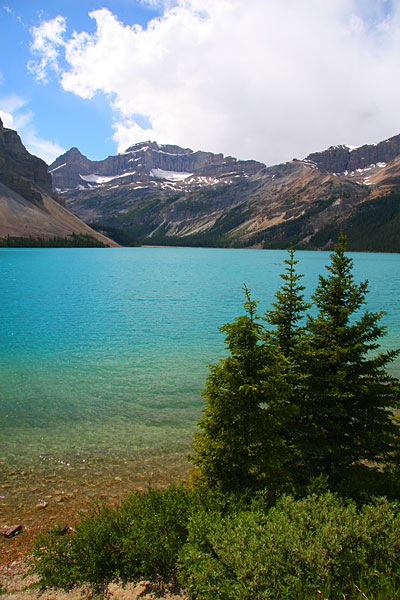
192km from Jasper
Yet another brilliant turquoise lake alongside the highway, Bow Lake is the source of the Bow River that flows through Banff and Calgary. This trademark opaqueness of blue and green is caused by what the local guides call "glacial rock flour," a suspension of microscopic clay particles filtering out part of the blue from the visible light spectrum.
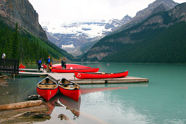
232km from Jasper
At the southern end of the Icefields Parkway, the world famous Lake Louise and the classy Fairmont Chateau beckons with its well manicured garden and the unbeatable view of the Victoria Glacier across the lake. In better weather we would have loved a romantic excursion on the emerald-coloured lake in one of these bright red canoes, rentable for about CAD$45 per hour. Hiking up to the Lake Agnes Teahouse is also a popular option in good weather, but on this day we opted for the leisurely Lakeshore Trail.
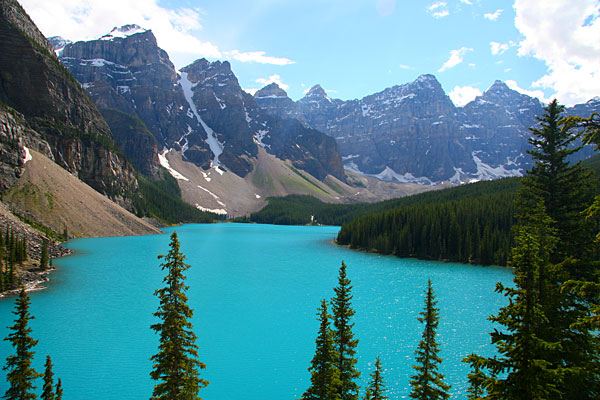
248km from Jasper
A 16km turn-off from Lake Louise village leads to an unbelievably blue lake, mysteriously opaque and bright and gracefully set beneath a series of majestic peaks. The view of Moraine Lake and the Valley of the Ten Peaks is one of the most-photographed locations in all of Canada, with obvious reasons -- the lake really is as blue as pictured above, and it is well-known locally as the image on older $20 banknotes. Do not expect a serene mountain surrounding when taking your obligatory photo though, as we had to hike past hundreds of tourists to the top of the rockpile for this shot.
260km from Jasper
Although the "Icefields Parkway" designation officially ends at Lake Louise, the highway keeps pointing southeast for another 56km before finally reaching Banff. Visitors have a choice of 2 roads -- the newer, faster throughfare of Highway 1, or the old, winding and more scenic Highway 1A, also known as the Bow Valley Parkway. The Bow Valley Parkway is supposed to be one of the prime wildlife-viewing areas in the Canadian Rockies, but we saw nothing bigger than squirrels along this road. The best wildlife-viewing area on our trip IMHO was Maligne Lake Road in Jasper National Park.
288km from Jasper
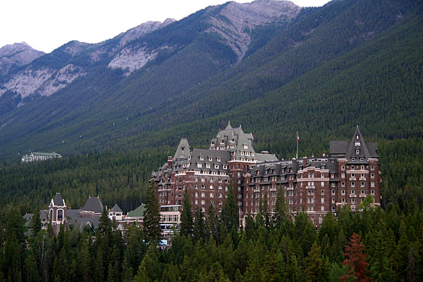
Banff, the mother of all Canadian resorts, awaited at the finish of our 8-hour-drive through the magnificent mountain scenery above. This would serve as our homebase for exploring the surrounding area for the next three days.

What better way to celebrate a great alpine drive than warming our hands around a bubbling cheese fondue in Old World tradition? Fairmont Banff Springs hotel's German restaurant, the Waldhaus, featured an excellent Gruyere fondue with generous shavings of black truffles for CAD$56 for a two-person serving. The pungent flavors of truffles was heavenly to my tastebuds, though my wife found it to be somewhat overpowering. This was one of the three best meals on our 15-day trip.